Art, Symbol & Imagination
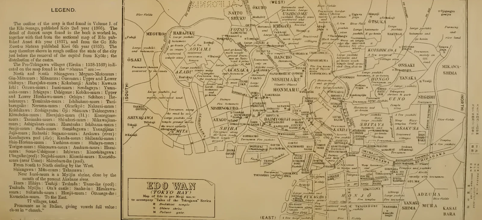
Edo before Tokyo: A Composite Historical Map
A broad urban plan spreads around waterways, streets and carefully divided districts. Its key explains the symbols used across the densely labelled city. The accompanying note describes a reconstruction based on maps dated 1853–1866, showing Edo before the capital moved from Kyoto.
Read the source pageLoading your collection…
Citation
Map maker not identified. "Edo before Tokyo: A Composite Historical Map" [editorial title]. In The Yotsuya Kwaidan; or, O'Iwa Inari, Retold from the Japanese originals by James S. de Benneville. Philadelphia: J. B. Lippincott Company, 1917; retold from Japanese originals by James S. de Benneville., 1917, Press of J. B. Lippincott Company. Source scan leaf 22. Lumitheca. /gallery/image/gallery-20261108-0446-0022
Source details
Editorial title and description. Source details from the Library catalogue.
Descriptive title supplied for the visually reviewed historical illustration. The surrounding book presents the original author's interpretation.
Sources
From the book
 The Yotsuya Kwaidan; or, O'Iwa InariRetold from the Japanese originals by James S. de Benneville1917
More from this book
All 3 illustrations

Related illustrations


Cite this illustration
Map maker not identified. Edo before Tokyo: A Composite Historical Map. The Yotsuya Kwaidan; or, O'Iwa Inari. Scan leaf 22. Lumitheca. https://lumitheca.com/gallery/image/gallery-20261108-0446-0022