Art, Symbol & Imagination
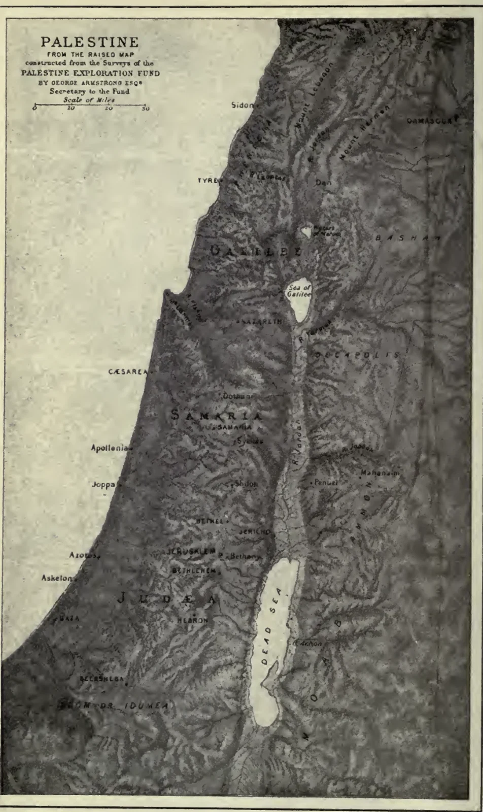
The Relief Map of Palestine
Dark relief shading models the hills around a long north-south valley. Town names, coastal labels and the inland lakes mark the geography of Palestine. The map provides a geographical setting for the journeys described in The Aquarian Gospel of Jesus the Christ.
Read the source pageLoading your collection…
Citation
Map maker not identified. "The Relief Map of Palestine" [editorial title]. In The Aquarian Gospel of Jesus the Christ, Levi; introduction by Eva S. Dowling. Inspected 1911 London/Los Angeles L.N.Fowler and E.S.Dowling printing, with Eva S.Dowling introduction, historical copyright and concluding chapter182., 1911, L. N. Fowler and Company; E. S. Dowling. Source scan leaf 8. Lumitheca. /gallery/image/gallery-20261108-0286-0001
Source details
Editorial title and description. Source details from the Library catalogue.
Descriptive title supplied for the visually reviewed historical illustration. The surrounding book presents the original author's interpretation.
Sources
From the book
 The Aquarian Gospel of Jesus the ChristLevi; introduction by Eva S. Dowling1911
Related illustrations


Cite this illustration
Map maker not identified. The Relief Map of Palestine. The Aquarian Gospel of Jesus the Christ. Scan leaf 8. Lumitheca. https://lumitheca.com/gallery/image/gallery-20261108-0286-0001