Occult Literature
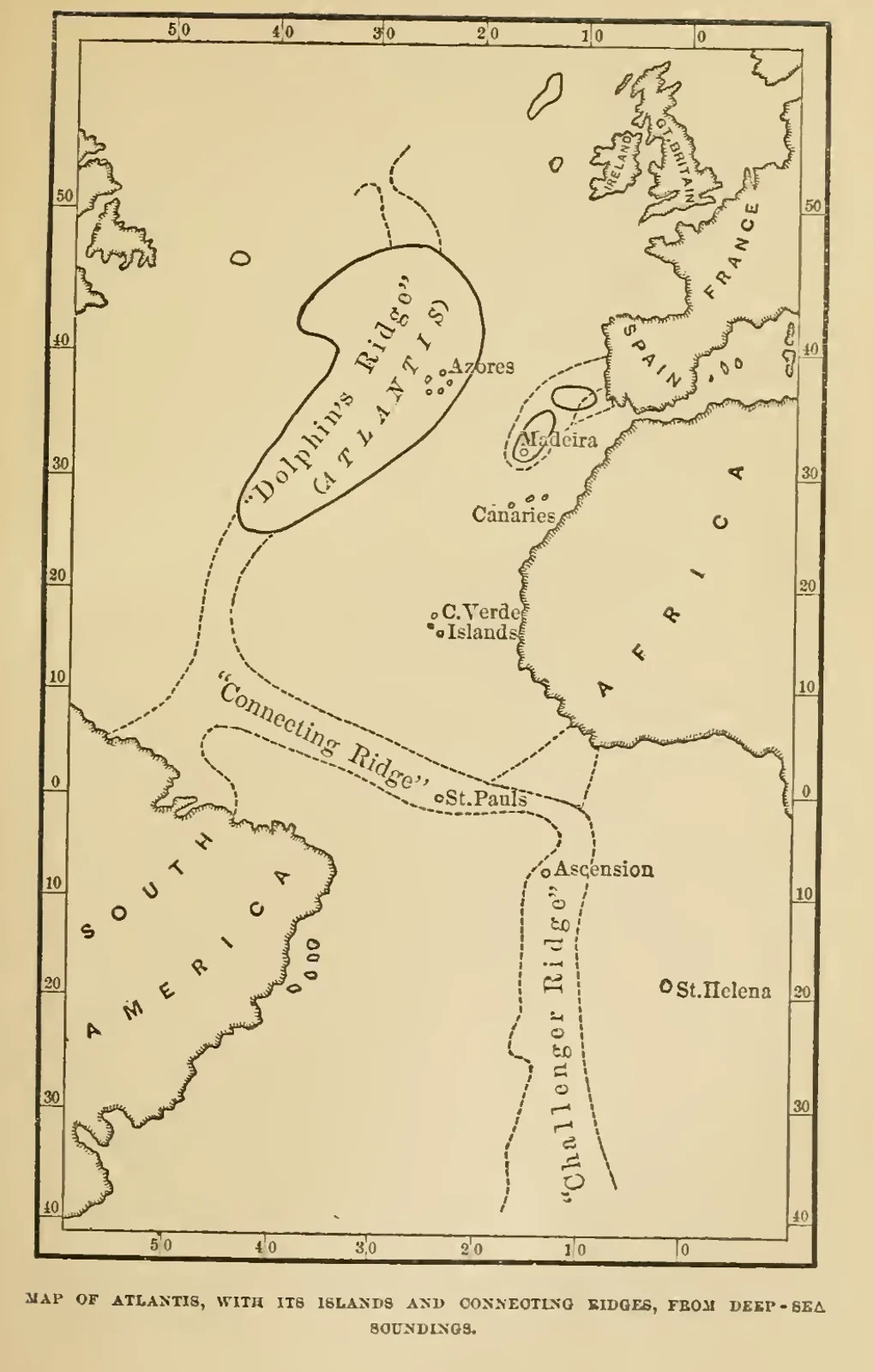
Donnelly’s Map of Atlantis and Atlantic Ridges
A proposed island occupies the central Atlantic between the surrounding continents. Labels mark Dolphin’s Ridge, connecting ridges, the Azores, Canary Islands and other places. The caption identifies a map of Atlantis derived from deep-sea soundings. It records Donnelly’s interpretation of those measurements within his lost-continent hypothesis, rather than an accepted reconstruction of a submerged civilisation.
Read the source pageLoading your collection…
Citation
Illustrator not identified. "Donnelly’s Map of Atlantis and Atlantic Ridges" [editorial title]. In Atlantis: The Antediluvian World, Ignatius Donnelly. Eleventh edition, undated imprint; copyright 1882, undated edition, Harper & Brothers. Source scan leaf 65. Lumitheca. /gallery/image/gallery-20261108-0071-0063
Source details
Editorial title and description. Source details from the Library catalogue.
Descriptive title supplied for the visually reviewed historical illustration. The surrounding book presents the original author's interpretation.
Sources
From the book
 Atlantis: The Antediluvian WorldIgnatius DonnellyUndated edition
More from this book
All 10 illustrations


Related illustrations


Cite this illustration
Illustrator not identified. Donnelly’s Map of Atlantis and Atlantic Ridges. Atlantis: The Antediluvian World. Scan leaf 65. Lumitheca. https://lumitheca.com/gallery/image/gallery-20261108-0071-0063